The weather had been dull and miserable for days, but the forecast suggested that we might actually see some sun on Thursday, so at the last minute I decided to pop into work for a couple of hours and then head west to walk another section of the SBP. Again, I planned using other footpaths to return to my car, a circular walk of around 12miles in total.
 |
| The SBP route |
The journey to Rusper took a bit longer than expected as I had to revise my route due to a road closure quite close to home. As a result it was 12.30pm before I set out from near the Royal Oak pub. As Steve was at work I had both dogs with me, and I hoped I wasn’t going to get in too much of a tangle trying to take photographs whilst having two dogs on flexi-leads!
 |
| Parked up in Friday Street and ready to start |
 |
| The Royal Oak |
Shortly after passing the pub, I branched right to join a footpath running alongside a hedge, then swung due north to cross several rather boggy fields, passing a large lake on my left. At several of the field boundaries the old stiles had been replaced by gates, but there was one particular stile that the dogs could not squeeze though and I had to help them over.
 |
| Ponds in adjacent field |
 |
| Jazz struggles in vain to squeeze through a stile |
After passing a motorbike scrambling track I reached a lane (Rusper Road) and turned left, crossing Fylls Brook. When the road veered right, I maintained direction on a path adjacent to Ridge Farm. As we approached there was much high pitched barking, and two very small dogs came out to confront us. Bearing in mind the size of Jazz, they were very brave (or foolhardy?!) to defend their property so vehemently.
 |
| Fylls Brook on Rusper Road |
 |
| Derelict barn at Ridge Farm |
Once the dogs were ushered back indoors by their owner we proceeded westwards across dryer fields, climbing very gently, to cross a railway, and then on to reach the A24.
 |
| Heading west towards the railway crossing |
 |
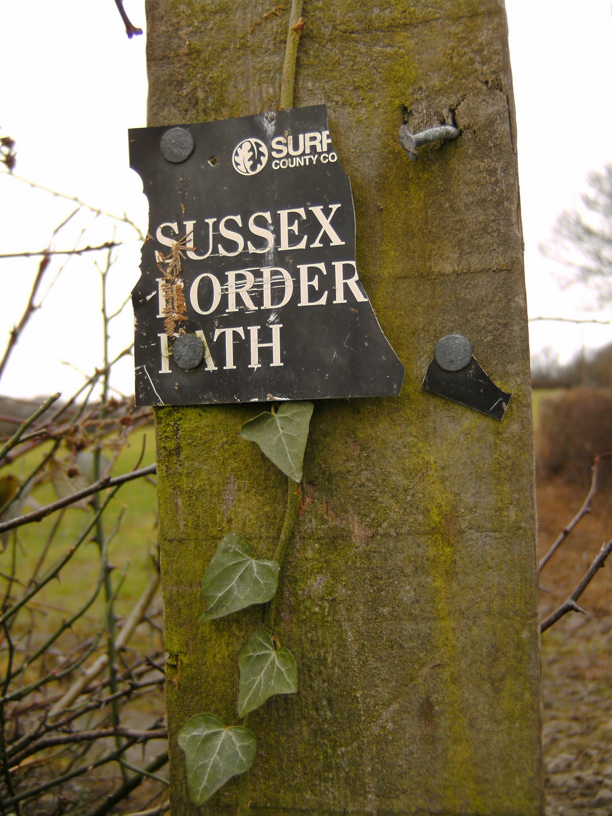
| Waymarker on rotten fence post |
Crossing straight over, the route followed the driveway to a farm marked on the map as Bonnetts. There were some quite nice views northwards, presumably to the Greensand ridge. After navigating our way through the farm buildings we descended through a meadow to cross a small strip of woodland called Grove Copse.
 |
| Views north |
 |
| Bonnetts Farm House |
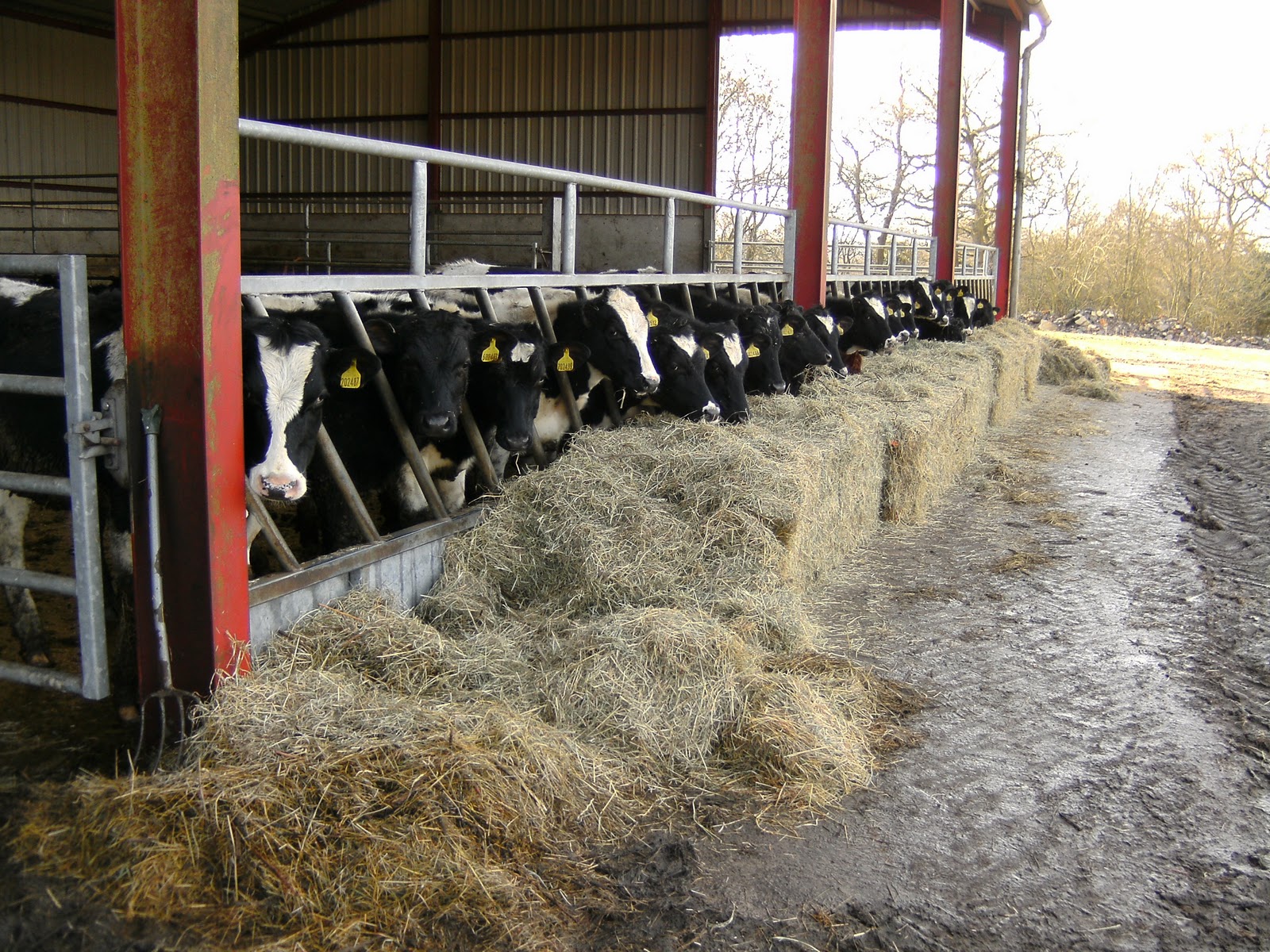
At Wattlehurst Farm we passed a pretty reed fringed pond, and then an open fronted barn full of heifers contentedly-munching their hay.
 |
| Looking north over the reed fringed pond |
 |
| Contented heifers munch on their hay |
Reaching the gateway to a field, I was just attempting to open it, when I realised there was a fenced track running alongside the field, which appeared to be the footpath. Backtracking a few yards, I found the correct route, and we followed this to reach a concrete access track called Smugglers Lane.
 |
| Fir trees adjacent to Smugglers Lane (bridlepath) |
 |
| The junction of Smugglers lane with Weare Street |
At the end of Smugglers Lane, I reached Weare Street, where I turned the wrong way (right), momentarily confused as to where I was on the map. Fortunately, I checked my GPS after a few seconds and realised my error so no damage was done. Staying on the lane for about ½ mile, we crossed North River and passed some pretty cottages at Paynes Green.
 |
| North River |
 |
| Paynes Green cottages |
Leaving the road, I turned south on a lovely green lane to reach Rowland Wood where I stopped for lunch, sitting on a convenient, oddly shaped tree trunk. The moss was a little damp though, so I had to sit on my map cover to avoid getting a soggy behind. My Morrisons sandwich (prawn mayo) was particularly disappointing, and the dogs ate most of the crusts in addition to the gravy bones I had brought them!
 |
| Green lane |
 |
| Lunch spot in Rowland Wood |
After lunch, I left the wood and continued south through meadows and crossed a stream (Tickfold Gill?). Reaching a T-junction of paths, the route turned west and passed the buildings of Denne Farm, which included a lovely timber framed farmhouse. The farm drive dipped down to cross Tickfold Gill again before climbing to reach the A29.
 |
| Denne Farm |
 |
| At the boundary with the A29 |
The SBP continued straight across the road, and up a fenced bridleway between two fields to reach a small patch of wood. Joining another track coming in from the right, I made my way along a wide muddy track for a further ½ mile before turning left on a narrower path. I was now following the course of Stane Street, a 56m long Roman road linking London with Chichester.
 |
| The bridleway leading west from the A29 crossing |
 |
| Stane Street |
Reaching Monks Farm there was another change of direction as I turned NW for about 1/3 mile along Monks Lane (bridleway) to reach Honeywood Lane, where the route immediately turned SE again to enter woods belonging to the Honeywood estate. There was a nice lodge house by the road, but I was not able to photograph it because the sun was in just the wrong place.
 |
| Haybarn at Monks Farm |
 |
| Forest management in the Honeywood Estate |
I continued on the path through damp, mossy woods for about a mile. At one point two deer appeared on the path ahead of us, but they were quite far away, so the dogs did not see them. However, I knew that as soon as we crossed their tracks the dogs would know they had been there, and sure enough, they picked up the scent and tried to drag me into the undergrowth in pursuit!
 |
| No time to stop for a rest if we want to finish this walk in the daylight! |
 |
| Part of Honeywood House |
As I left the woods, I passed Honeywood House on the left which is clearly a house of some size (although I couldn’t really see much of it from the path), with its extensive grounds and both a north and south lodge house. I haven’t been able to find out anything about its history on the internet, but its current use is as a nursing home. Walking across a field for about 150m, adjacent to the house driveway, I reached Rowhook Road, and the end of this section of the SBP.
 |
| Reaching Rowhook Road, that completes SBP for today |
Key points of return trip:
- The bridleway up Honey Lane was very wet – at one point we were confronted by a completely flooded gate, and the only option was to edge round the side, and climb through the fence. The picture does not show it, but nearer to the gate, the water appeared to be at least a foot deep.
 |
| Flooded bridleway, Honey Lane |
- My route took me back to Monks Farm, visited on the outward route, but never quite converging with the SBP. I got my navigational knickers in a bit of a twist here and twice had to rely on GPS to stop me going the wrong way (rubbish map reading!).
 |
| "Excuse me, can you direct me to the footpath?" |
- At Dawes Farm (I think) we were greeted by a couple of very large snarling dogs in a garden that didn’t appear to be fenced very adequately. I was also perturbed to see that the front gates were open, and felt sure that they would rush out and kill us all. However, I guessed (correctly) that they were wearing some kind of electric collar that zaps them if they cross their boundary, and indeed one of them got a bit close to the gateway and yelped loudly. I don’t have a photo of the slavering beasts due to my unease and wish to hurry past.
 |
| Willow and pond at Dawes Farm (much more serene than the ferocious dogs!) |
- After crossing the A29, I had to get the dogs over a difficult stile from a verge about 1 foot wide. The evening rush hour had already started and the traffic was whizzing past my back at about 50 mph which was very scary and dangerous. Having negotiated the stile we had to cross a recently ploughed field. Fortunately the farmer had partially reinstated the path using his tractor, but it was still a bit tricky to walk on.
 |
| Poppy contemplates the partially reinstated path across the plough |
- There then followed nearly 2 miles of road walking. From the map I had hoped the road would be quiet, but at 4.30pm there was a reasonable amount of fast moving traffic. I had to keep crossing from one side to the other, depending on the bend of the road, and/or the availability of a grass verge.
 |
| The route along Marches Road goes on and on |
- Reaching the railway line east of Kingsfold, I was confronted with a very high stile, which Jazz could not squeeze through, however hard she tried. In the end I had no option but to practically lift her over, whilst standing astride it (Jazz is rubbish at climbing stiles). She weighs 35kg, and was also absolutely filthy due to the very muddy conditions underfoot, so it is not something I was overly keen to do! Poppy fortunately managed to squeeze between the slats, and both dogs managed to edge past the side of a duplicate stile on the other side of the tracks.
 |
| The offending railway stile |
- Just when I thought I was home and dry, one of the last fields had been recently re-fenced, and the contractor had kindly replaced the stile with a smart new metal pedestrian gate. Unfortunately he had not fitted it very well, and however hard I pushed and pulled, I couldn’t open it! The gate itself was high, and the fences either side were topped with barbed wire – getting both dogs over was going to be virtually impossible. As a last resort I tried to work the catch whilst actually standing on the gate, and thankfully, this lowered it sufficiently to release it, although I had to swing the gate open before getting off it.
 |
| Thank you, Tim Bennet for nearly ruining the end of my walk! |
This last hurdle overcome, I finally arrived back at the car at 5.40pm, and dusk had certainly fallen. We were all pretty muddy, particularly Jazz. However, despite bringing various towels, I really couldn’t make any impression on her long fur, and I’m afraid she had to remain in a filthy state for the 1 hour journey home, until I could wash it all off her with warm water.
 |
| Lovely sunset |
Despite the mud, and the problems we encountered on the return route, this was a nice walk, even without many extensive views. The sunny, mild weather certainly had a lot to do with it (I didn’t even need a jumper for most of the walk), and was a promise of spring just round the corner. Now, if only all that mud could dry up.......!
 |
| Return route |